Agronomy Services
Sectors
- Agronomy Services
- Autonomous vehicles
- EssentialsNetRTK correction network
- KORE precision farming portal
- Projects
- SKAi retrainable spot spraying system
Featured Case Study
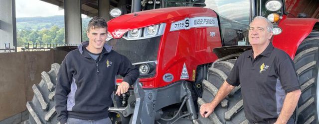
Angus Bryce, D Bryce & Sons
Find out more
Featured Case Study
Tim Young, JS Young Farms
Find out more
Save on costs by targeting your inputs to soil types and conditions.
Use our precision farming platform, eligible under the new SFI scheme in England!
Find out moreUse KORE, our independent precision farming platform to improve your client management, increase efficiency and enhance your agronomy and soil sampling services.
For more information call the office on 01356 650459 (option 1) or Ed on 07425 338545.

For XCN, GFX, NAV 900 and other Trimble RTX displays
Renew your RTX subscription from £260pa*
Find out moreIf you're feeling the winter blues about your RangePoint RTX renewal, warm up with a new subscription from only £260 pa*
SoilEssentials are your longstanding, independent Trimble authorised dealer in Scotland and Northern UK.
To renew your RangePoint RTX subscription call the office on 01356 650459 (option 1), Rod on 07824 617153 or Bob on 07827 480056.
*Ts&Cs apply. Price applies to a 5-year upfront contract. Open to all RTX customers.
SoilEssentials are able to help farmers monitor and manage their fields, yields and profitability through a whole suite of integrated precision agronomy services throughout the seasons.
Know your soil status with our full soil sampling and reporting service, complemented with area measuring, and drone flying operations.
Soil Sampling
Accurately determine the pH, organic content and nutrient levels of your soil. Our pH soil sampling service uses GPS technology for a repeatable, accurate, and professional mapped job, managed and delivered by our own dedicated soil sampling team, operating across Scotland and Cumbria.
> A complete, tailored, soil sampling and reporting service
> 4 samples/ha as standard with grassland options available (see GrassRight)
> Intensive sampling efficiently tracks variable pH levels to target lime inputs
> Zone or field-based sampling for nutrients
> Reports on all soil status, nutrients, pests & diseases
> Analysis carried out by Scottish labs or a lab of your choice
> Reports delivered using our unique online mapping application, KORE
GrassRight
GrassRight helps you get the fundamental building blocks just right with a select range of sampling options – three tier grassland soil sampling packages, plus a DIY option.
Nutrient availability is at its best when pH is just right. We will sample your fields in detail for pH and at sensible levels for micro-nutrients. Lime can be applied variably and the correct nutrients applied for each field too – all for great growing grass.
Soil Mapping
We can create simple, easy-to-understand field maps showing pH and nutrient variability. In addition, we can give you access to our KORE online portal where variable rate spreading files are easily produced for sending direct to your contractor.
Area Measuring – for easier completion of required forms
Land measurement is crucial for gaining the right information for improved management. Our area measuring service uses GPS technology for a repeatable, accurate, and professional mapped job.
> Take advantage of a full and accurate GPS area measuring service using Trimble handheld devices or RTK drone, with correction gained from EssentialsNetRTK, our very own RTK correction network
> Measure and map new boundaries, rented land and new drains
> Make integrated plans to complement your other farming operations
> Make more informed decisions
More information: Area Measuring
Drone Flying
Drone flying and the resultant images give the most detailed and comprehensive view of what is happening in a crop. Ideal for assessing performance in all aspects of production. Our team can fly our drones over your fields to create very high definition images which can then be viewed, analysed and used as a basis for applications in our online platform, KORE.
More information: Drone Flying
Related Products
Related Services
Start the conversation
Contact us
Featured Case Study
Angus Bryce, D Bryce & Sons
Find out more
Featured Case Study
Tim Young, JS Young Farms
Find out more
Save on costs by targeting your inputs to soil types and conditions.
Use our precision farming platform, eligible under the new SFI scheme in England!
Find out moreUse KORE, our independent precision farming platform to improve your client management, increase efficiency and enhance your agronomy and soil sampling services.
For more information call the office on 01356 650459 (option 1) or Ed on 07425 338545.
For XCN, GFX, NAV 900 and other Trimble RTX displays
Renew your RTX subscription from £260pa*
Find out moreIf you're feeling the winter blues about your RangePoint RTX renewal, warm up with a new subscription from only £260 pa*
SoilEssentials are your longstanding, independent Trimble authorised dealer in Scotland and Northern UK.
To renew your RangePoint RTX subscription call the office on 01356 650459 (option 1), Rod on 07824 617153 or Bob on 07827 480056.
*Ts&Cs apply. Price applies to a 5-year upfront contract. Open to all RTX customers.