Latest
Archive
- March 2024
- February 2024
- January 2024
- November 2023
- October 2023
- August 2023
- July 2023
- June 2023
- May 2023
- April 2023
- March 2023
- February 2023
- January 2023
- November 2022
- September 2022
- August 2022
- July 2022
- June 2022
- May 2022
- April 2022
- February 2022
- January 2022
- December 2021
- November 2021
- September 2021
- August 2021
- July 2021
- June 2021
- May 2021
- April 2021
- February 2021
- November 2020
- October 2020
- September 2020
- August 2020
- July 2020
- June 2020
- May 2020
- April 2020
- March 2020
- February 2020
- January 2020
- December 2019
- November 2019
- October 2019
- September 2019
- July 2019
- June 2019
- May 2019
- April 2019
- February 2019
- January 2019
- December 2018
- November 2018
- October 2018
- July 2018
- June 2018
- May 2018
- March 2018
- February 2018
- January 2018
- December 2017
- November 2017
- October 2017
- September 2017
- August 2017
- July 2017
- June 2017
- May 2017
- March 2017
- February 2017
- December 2016
- November 2016
- October 2016
- August 2016
- July 2016
- June 2016
- April 2016
- February 2016
- December 2015
- November 2015
- September 2015
- August 2015
- July 2015
- June 2015
- April 2015
- March 2015
- February 2015
Featured Case Study
Angus Bryce, D Bryce & Sons
Find out more
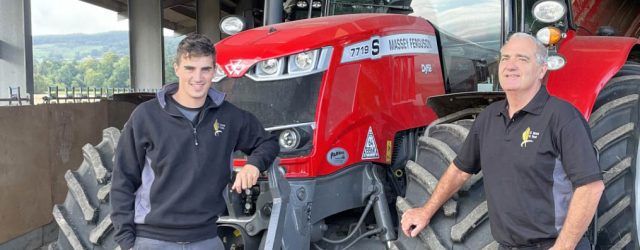
Featured Case Study
Tim Young, JS Young Farms
Find out more
Save on costs by targeting your inputs to soil types and conditions.
Use our precision farming platform, eligible under the new SFI scheme in England!
Find out moreUse KORE, our independent precision farming platform to improve your client management, increase efficiency and enhance your agronomy and soil sampling services.
For more information call the office on 01356 650459 (option 1) or Ed on 07425 338545.

For XCN, GFX, NAV 900 and other Trimble RTX displays
Renew your RTX subscription from £260pa*
Find out moreIf you're feeling the winter blues about your RangePoint RTX renewal, warm up with a new subscription from only £260 pa*
SoilEssentials are your longstanding, independent Trimble authorised dealer in Scotland and Northern UK.
To renew your RangePoint RTX subscription call the office on 01356 650459 (option 1), Rod on 07824 617153 or Bob on 07827 480056.
*Ts&Cs apply. Price applies to a 5-year upfront contract. Open to all RTX customers.
First launched in 2012, EssentialsMap is an intuitive online farm mapping system allowing customers to manage spatial farm data such as soil sampling, yield mapping and variable rate map production. The new version takes advantage of the wider availability and lower cost of Earth Observation (EO) data to develop this effective online tool. The brand new cloud-based version takes the user into a unique online environment giving unparalleled data retrieval capability and access to imagery. The EssentialsMap development was co-funded by the European Space Agency (ESA) in an integrated applications R&D project named KORE (Knowledge, Observation, Response, Evaluation) and sees several complementary services integrated into a unified farm management solution. EssentialsMap is the first cloud-based farm management system to be integrated with Trimble‘s Connected Farm which allows variable rate application maps to be sent directly to the user’s Trimble console without using a USB stick. SoilEssentials are delighted to have collaborated with ESA alongside satellite data processing experts- Deimos Space UK Ltd and drone solutions company – G2Way.
The KORE project developed a platform to combine EO imagery from a variety of sources including ESA’s new Sentinel series of satellites, UAV imagery and tractor-mounted sensors to guarantee the availability of remote-sensed data, regardless of weather and cloud conditions. This remote-sensed imagery is captured at a range of scales from centimetre level from UAV’s, 1 to 20 metre for Satellite imagery and tramline width for tractor-mounted sensors. The appropriate EO data is retrieved specifically for the agriculture industry and opens up a new dimension for agronomists and farming companies to increase their land knowledge and offer a unique service to their clients through the EssentialsMap product. Challenging projects like these continually push the boundaries in this fast-moving industry and SoilEssentials stand at the front of the queue to get involved and progress. Managing Director of SoilEssentials, Jim Wilson explains, “Our aim with the KORE project and the new version of EssentialsMap was to create a unique white box web platform for agronomists to rebrand and tailor to their, and their customers’ own needs. We also wanted to dramatically improve the reliability and usability of remote-sensed imagery and we have achieved that with the seamless integration of multiple providers of satellite imagery, UAV images and tractor mounted sensors.”
Michael Lawrence, Business Development Director of Deimos Space UK Ltd tells us “Our experience in managing and processing large volumes of EO data has enabled us to combine EO data and UAV data to feed the analytic tools in the new version of EssentialsMap.”
“By using micro unmanned aircraft vehicles (UAVs) to produce timely high resolution earth surface imagery we support users that require images to observe the key stages of the crop growth cycle,” says Keith Geary, founder of G2Way, “and on the occasions where there are feasibility issues regarding satellite acquisitions due to cloud cover, existing users of EO can also be supported through this avenue.”
Visitors can find SoilEssentials on stand 321 at Cereals and on Avenue Q at The Highland Show where they will be delighted to talk to you and where you have the opportunity to preview this exciting new farm management solution.
The SoilEssentials expertise lies where technology and good farming practice merge, providing practical solutions designed primarily with agricultural efficiency in mind. With an extensive product and service portfolio, SoilEssentials complement this with their status as authorised Trimble dealer for Northern UK.
Deimos Space UK Ltd, based in Harwell, near Oxford, has extensive experience in design, engineering and systems integration in the aerospace, satellite systems, remote sensing, information systems and telecommunications network sectors and is involved in the majority of ESA programmes including exploration, Earth observation, satellite navigation, launchers and human space flight.
G2Way Ltd is a geospatial technology company based in Nottingham and was created to develop global two-way communications and navigation.
The European Space Agency (ESA) is Europe’s gateway to space. Its mission is to shape the development of Europe’s space capability and ensure that investment in space continues to deliver benefits to the citizens of Europe and the world.
For further information regarding EssentialsMap please contact Jim Wilson, Managing Director on 01356 650459 or email: jim@soilessentials.com
13 April 2016 News
Featured Case Study
Angus Bryce, D Bryce & Sons
Find out more
Featured Case Study
Tim Young, JS Young Farms
Find out more
Save on costs by targeting your inputs to soil types and conditions.
Use our precision farming platform, eligible under the new SFI scheme in England!
Find out moreUse KORE, our independent precision farming platform to improve your client management, increase efficiency and enhance your agronomy and soil sampling services.
For more information call the office on 01356 650459 (option 1) or Ed on 07425 338545.
For XCN, GFX, NAV 900 and other Trimble RTX displays
Renew your RTX subscription from £260pa*
Find out moreIf you're feeling the winter blues about your RangePoint RTX renewal, warm up with a new subscription from only £260 pa*
SoilEssentials are your longstanding, independent Trimble authorised dealer in Scotland and Northern UK.
To renew your RangePoint RTX subscription call the office on 01356 650459 (option 1), Rod on 07824 617153 or Bob on 07827 480056.
*Ts&Cs apply. Price applies to a 5-year upfront contract. Open to all RTX customers.